What Is Computer-Aided Dispatch? A Complete Guide to CAD Systems
Understand how computer-aided dispatch systems manage incidents, recommend resources, integrate GIS and communications, support field responders, and improve coordination across public safety and service operations.
Becke Telcom
Introduction
In an age where seconds can mean the difference between life and death, the technology that coordinates emergency response behind the scenes is more critical than ever. At the heart of modern public safety and many service industries lies the Computer-Aided Dispatch (CAD) system. Far more than a digital rolodex, a CAD system is a sophisticated, centralized platform that automates the entire lifecycle of incident management — from the moment a call for help is received to the final report after the scene is cleared.
While most people are familiar with the sight of police cars, ambulances, and fire trucks racing to an emergency, few understand the complex orchestration happening inside the dispatch center. This guide provides a complete exploration of CAD systems: what they are, how they work, their evolution, core features, benefits, challenges, and where the technology is heading next.
1. What Is Computer-Aided Dispatch?
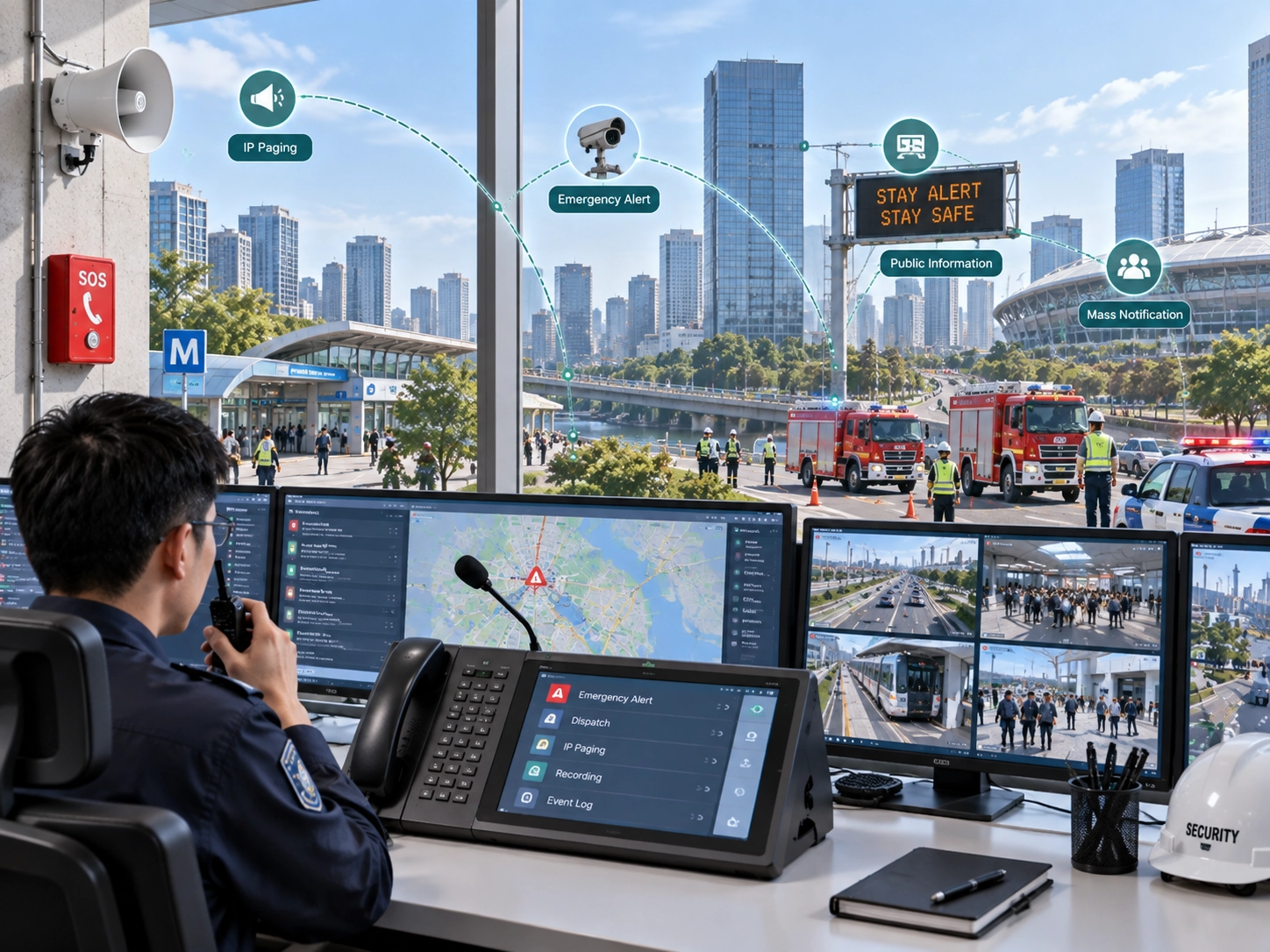
Computer-Aided Dispatch (CAD) is a software and hardware system used by dispatchers and call-takers to manage and coordinate responses to incidents. The system receives, creates, prioritizes, tracks, and archives service calls, automatically assigning the most appropriate field resources based on location, availability, and skill set.
Think of a CAD system as the brain of a dispatch center. It integrates multiple data streams — incoming calls, real-time GPS locations of field units, mapping software, and historical records — into a single, user-friendly interface. This allows a dispatcher to see the entire operational picture at a glance and make informed decisions in real time.
While CAD is most commonly associated with emergency services (police, fire, and Emergency Medical Services), it is also widely used in:
Public transportation (buses, trains, paratransit)
Taxi and ride-hailing services
Towing and roadside assistance
Utility field service management
Courier and logistics companies
Regardless of the industry, the core promise of CAD remains the same: get the right resource to the right place at the right time, with the right information.
2. A Brief History of CAD Systems
The evolution of CAD is a story of continuous innovation driven by the need for speed and accuracy.
Pre-1960s – The Manual Era: All dispatch was done manually. Call-takers wrote information on punch cards or paper forms. Runners would physically carry the cards to dispatchers, who used two-way radios and status boards with magnetic tags or lights to track unit availability. Response times were slow, and the risk of human error was high.
1970s – The First Mainframe CAD Systems: The rise of mainframe computers enabled the first electronic dispatching. These early systems were basic, text-only, and incredibly expensive, limiting them to large metropolitan agencies. They could store address databases and log calls digitally, but still lacked graphical interfaces and real-time mapping.
1980s-1990s – The PC and GUI Revolution: Personal computers and graphical user interfaces transformed CAD. Mapping was introduced, allowing dispatchers to visualize call locations. Enhanced 911 (E911) technology automatically fed caller location and phone number into the CAD, eliminating the need for a call-taker to ask, "Where is your emergency?"
2000s – Mobile Data and AVL: Mobile Data Terminals (MDTs) in vehicles connected officers directly to the CAD system. Automatic Vehicle Location (AVL) via GPS provided real-time unit positions on the map. This meant dispatchers no longer had to rely on voice status updates; they could see exactly where every unit was.
2010s to Present – Cloud, AI, and Interoperability: Modern CAD systems are cloud-native, enabling remote dispatching and disaster recovery. Artificial intelligence aids in call prioritization and unit recommendation. Crucially, CAD now acts as the hub for a vast ecosystem of interoperable systems, including records management (RMS), jail management, and statewide/national databases.
3. Core Components of a CAD System
A modern CAD system is not a standalone piece of software; it is an integrated suite of components working in concert.
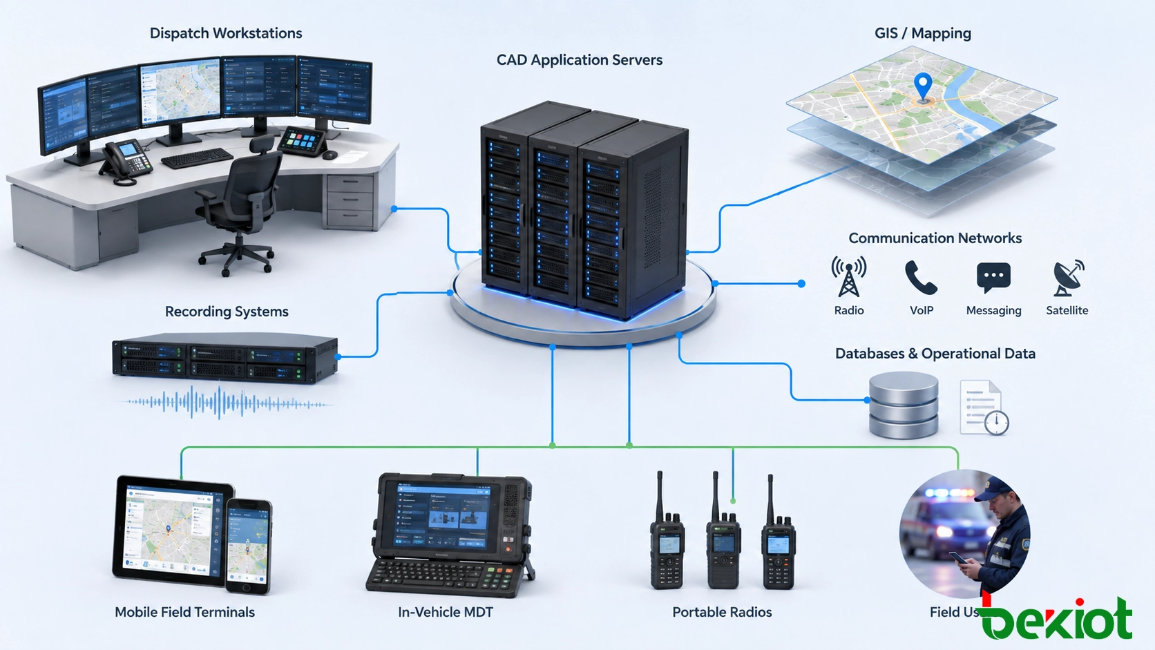
A CAD platform connects dispatch workstations, operational data, communication systems, maps, and field users.
3.1 Hardware Infrastructure
Servers: Physical on-premise servers or cloud-based virtual servers that host the CAD software and databases.
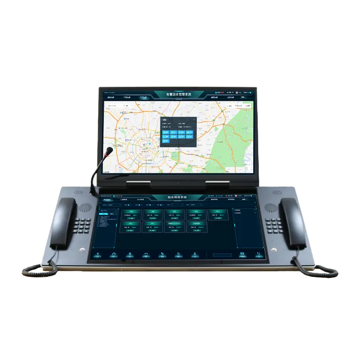
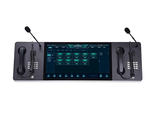
Dispatch Workstations: High-performance computers with multiple monitors, allowing dispatchers to view CAD, maps, radio controls, and video simultaneously.
Mobile Data Terminals (MDTs): Ruggedized laptops or tablets in field units that run a mobile version of CAD.
Network and Redundancy: Highly resilient networks with failover capabilities to ensure 99.999% uptime, often including backup generators and secondary data centers.
3.2 Software Modules
Call-Taking Interface: The screen where call-takers log incident details as they talk to a caller. It uses a guided script (often based on the International Academies of Emergency Dispatch's protocols) to ensure consistent questioning.
Dispatch Module: The main map-centric screen showing active calls, unit locations, and status. It includes tools for unit recommendation and tactical decision support.
Mapping and GIS: A Geographic Information System engine (like ESRI ArcGIS) integrated directly into the CAD. It validates addresses, geocodes incident locations, and provides routing and situational awareness layers (e.g., hydrant locations, floor plans, hazardous material sites).
Administration Module: Used for system configuration, user management, unit roster maintenance, and building the core geographic jurisdiction data ("geo-files").
3.3 Interfaces and Integrations
This is where CAD truly becomes a hub:
Telephony Interface: Direct link to the phone system (PBX and 911 trunk) to capture Automatic Number Identification (ANI) and Automatic Location Identification (ALI).
Radio Interface: Connects the CAD to the land-mobile radio system, allowing dispatchers to click a button in CAD to initiate a radio call on a selected talk group.
Records Management System (RMS) Interface: Feeds closed incident data into the RMS for report writing, investigative analysis, and archival.
AVL Data Feed: Receives a constant stream of GPS coordinates from field units.
External Database Queries: The CAD can automatically query state motor vehicle databases, criminal justice information systems, and national wanted person files based on a license plate or name entered by a dispatcher, returning results directly to the CAD and the officer's MDT.
4. How a CAD System Works: The Dispatch Lifecycle
To understand CAD, you must follow a typical incident through its entire lifecycle.
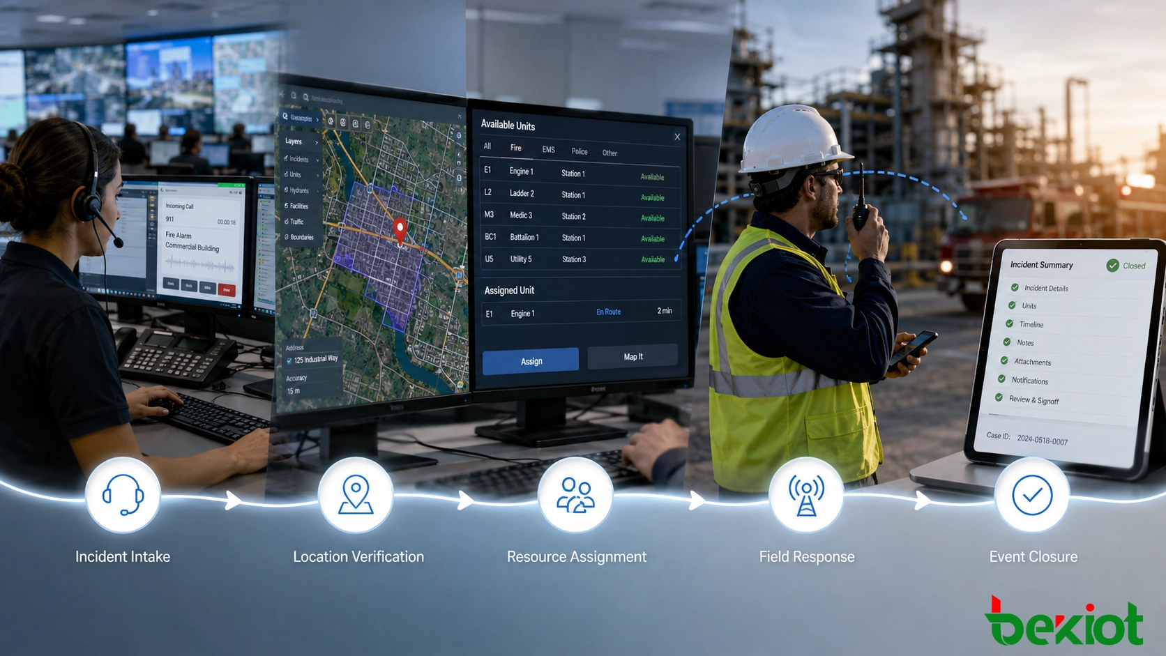
A typical CAD workflow connects incident intake, dispatch decisions, field updates, and final documentation.
Step 1: Call Reception & Cradle-to-Grave Record Creation A citizen dials 911. The phone system instantly delivers the caller’s phone number (ANI) and registered address (ALI) to the CAD. The call-taker's screen auto-populates with this data and creates a unique incident record. Even if the caller hangs up, a record now exists.
Step 2: Incident Categorization and Prioritization Following a protocol, the call-taker asks key questions: "What is the emergency?" "Where is it?" "Is the suspect still on scene?" Based on the answers, the call-taker selects a nature code (e.g., "BURG-RES" for residential burglary, "CARD-ARR" for cardiac arrest). The CAD automatically assigns a priority level (1 through 5, with 1 being life-threatening). This priority determines the response configuration — how many units, and whether they respond with lights and sirens.
Step 3: Unit Recommendation and Dispatch The moment a valid address is entered, the CAD's recommendation engine activates. It analyzes the unit plan or beat structure, the real-time GPS location of every unit, their current status (available, on a call, out of service), and their capabilities (e.g., a paramedic unit vs. a basic life support unit). The system highlights the closest, most appropriate available unit(s). The dispatcher can accept the recommendation with a single click or override it manually. The dispatch is then sent to the unit’s MDT, often accompanied by a silent notification tone instead of a blaring radio call.
Step 4: Mobile Response and Status Updates The responding officer sees the call details pop up on their MDT, including a map with the route highlighted. They press an "En Route" button. The CAD updates their status and icon on the dispatcher's map. Dispatchers can monitor the unit’s progress along the route. Once on scene, the officer presses "On Scene," and the system logs the timestamp precisely.
Step 5: Resolution and Closing Once the incident is stable, the officer goes "In Service" and may create a brief CAD narrative summarizing the outcome. In many systems, this closure in CAD triggers the automatic creation of a shell report in the RMS, prepopulated with all the CAD data — time stamps, location, involved persons, and narrative — so the officer only needs to add the detailed narrative of their investigation.
5. Types of CAD Systems by Industry
While the core concept is universal, CAD systems are tailored to the unique workflows of each sector.
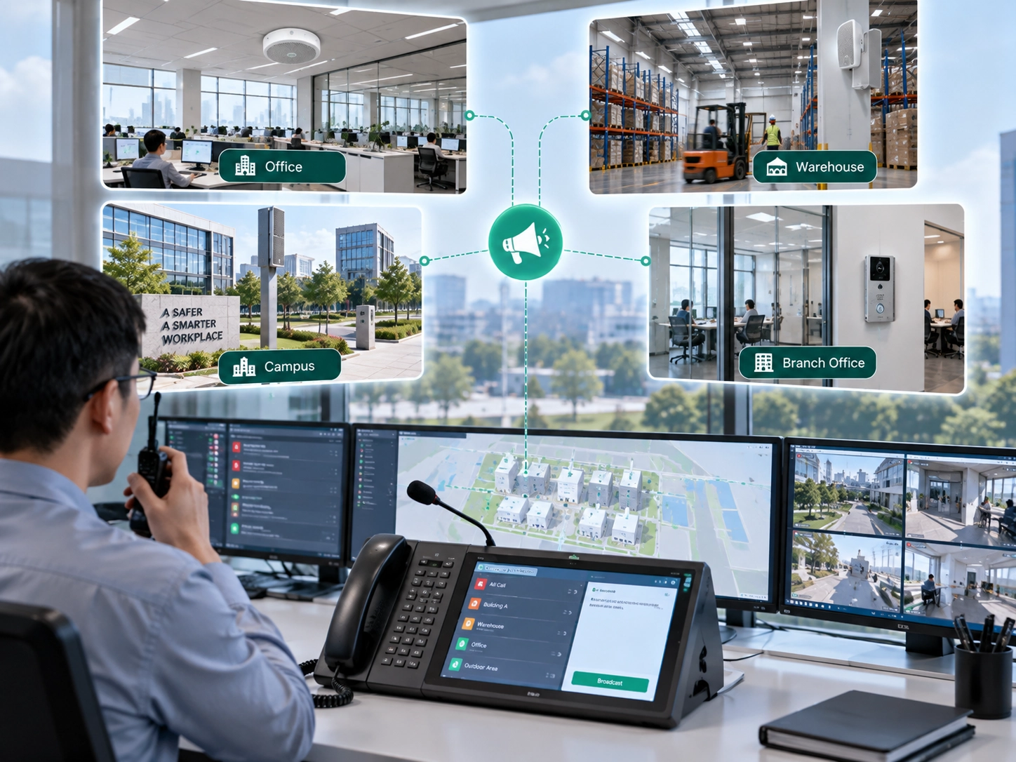
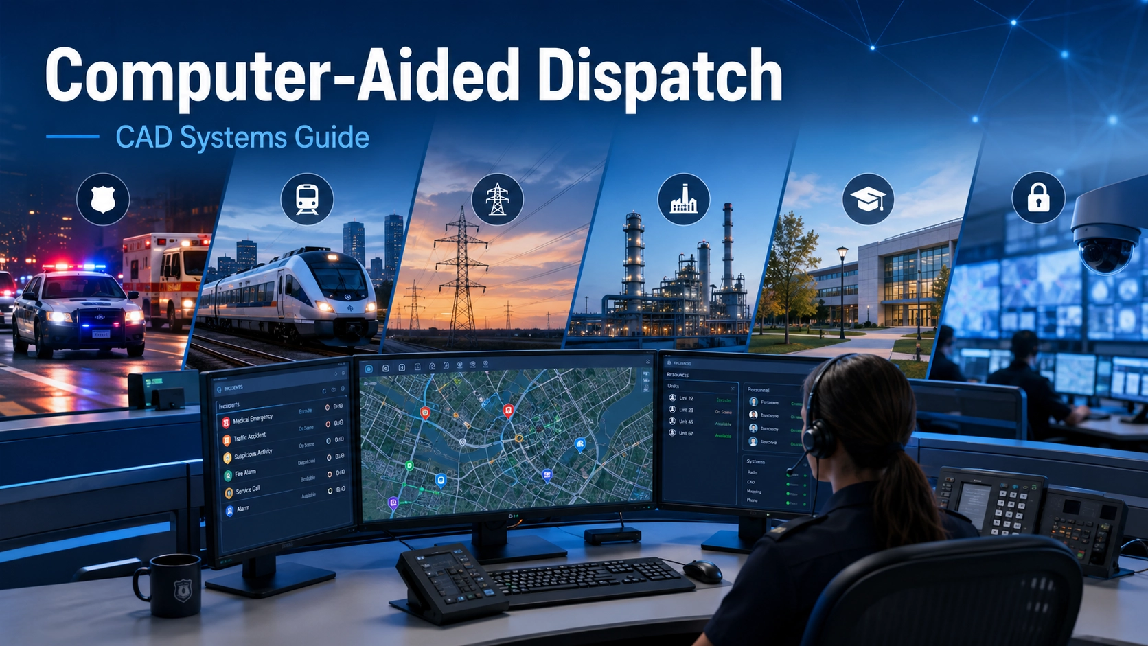
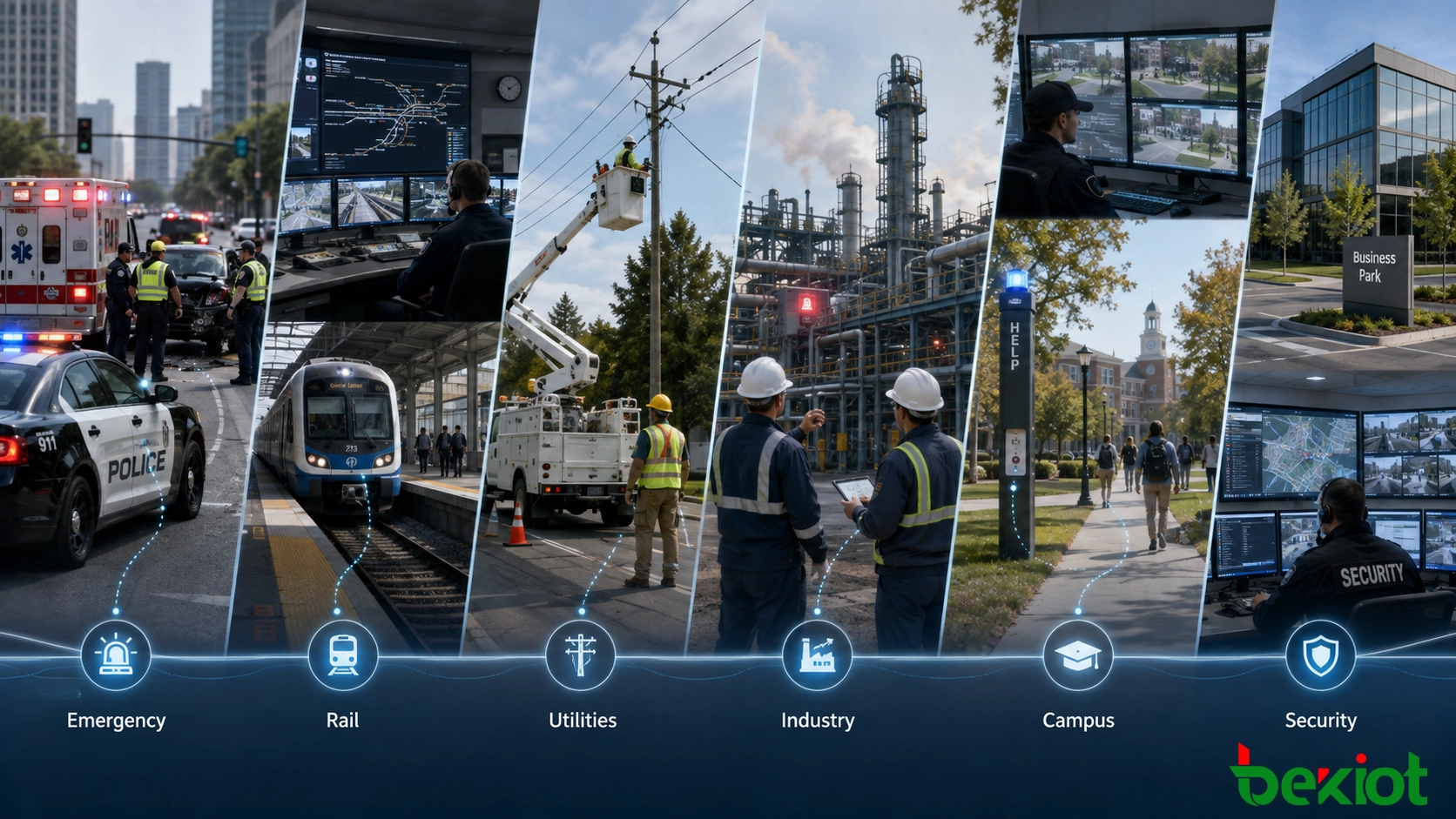
CAD and CAD-style platforms support different response workflows across public safety, transportation, utilities, industry, and managed facilities.
Public Safety CAD
This is the most complex and feature-rich category. It must handle multi-agency dispatching (a single call might require police, fire, and EMS). It includes rigorous security protocols for accessing criminal justice databases (CJIS compliance) and supports mission-critical functionalities like officer-down emergency buttons and interoperability with neighboring jurisdictions.
Transportation CAD
Used by transit authorities and school bus fleets. It focuses on schedule adherence, route optimization, and passenger counting. "Incidents" might be a delayed bus, a vehicle breakdown, or a passenger disturbance. Integration with on-board cameras and automated stop announcements is common.
Field Service CAD
Used by utility companies (electricity, water, cable), telecommunications, and HVAC services. Work orders, not emergency calls, are the primary record. The CAD assigns technicians based on skill code (e.g., certified to work on high-voltage lines), available parts in the vehicle inventory, and proximity to the job site. The goal is workforce optimization and meeting customer appointment windows.
Ride-Hailing & Logistics CAD
Uber and Lyft use a massively scaled, consumer-grade version of CAD. The "call-taker" is the passenger app, the "unit recommendation" is the rider-driver matching algorithm, and "AVL" is the constant GPS tracking both parties see. Dispatch happens in milliseconds, and "incidents" are completed rides.
6. Key Features and Functionalities
What are the specific tools inside a CAD that create efficiency?
Real-Time Unit Status and AVL: A map displaying every unit with color-coded icons (green for available, red for busy, blue for en route). Clicking an icon reveals the unit's ID, officer name, and current assignment.
Geo-Validation and Spatial Awareness: When an address is entered, the system instantly validates it against the master address database. It doesn't just find a dot on a map; it understands "geofences" — the operational boundaries of beats, precincts, and jurisdictions. If a caller is at a known hazard location, a silent alert can warn the dispatcher.
Intelligent Unit Recommendation: Algorithms that consider not just straight-line distance but drive time, traffic, and unit capability. For a cardiac arrest, the CAD can simultaneously recommend the closest paramedic ambulance and the closest fire department first-responder unit with an AED.
Integrated Radio and Telephony Control: A unified console where the dispatcher can click on a unit icon to initiate a radio call or click on a phone number in the call history to dial back a caller, all without leaving the CAD environment.
Tactical Mapping and Premise Information: Beyond roads, the map can display layers for active fire hydrants, building floor plans, the location of hazardous chemicals, and real-time video feeds from nearby cameras. A hazardous materials spill (HazMat) can trigger an automatic recommendation to evacuate a defined radius.
Event Timelines and Audit Trails: A legally defensible, unalterable timestamp log of every action: when the call rang, when it was answered, when it was dispatched, when the unit arrived, and every status change in between. This is critical for legal proceedings and internal performance review.
Instant Messaging and Silent Communication: A secure internal messaging system allows dispatchers to send sensitive information (e.g., a suspect's detailed description, warrant confirmation) that shouldn't be broadcast over the radio.
7. Benefits of Implementing a CAD System
The return on investment for a CAD system is measured in lives saved, injuries prevented, and costs reduced.
Drastically Reduced Response Times: Automated unit recommendation eliminates the seconds lost to a dispatcher looking at a status board. Pre-populated address data avoids miscommunication. MDT dispatching takes seconds instead of a voice dispatch cycle that could take a minute or more.
Enhanced Officer, Responder, and Public Safety: An officer responding to a domestic violence call is automatically provided with the call history at that address, a list of involved persons, and any associated weapons alerts. The officer’s danger is reduced because the unknown is made known. The silent emergency button on an MDT immediately triggers a priority alarm on the dispatcher's screen, showing the officer’s exact location.
Improved Resource Management and Efficiency: Dispatchers can see the exact location and status of every unit, preventing the inefficient practice of "spinning" a unit (sending one from far away when a closer one is available but out of sight). Data analytics generated by CAD show peak call volumes, allowing chiefs to adjust staffing schedules accordingly.
Data-Driven Accountability and Reporting: CAD data provides objective, verifiable metrics for agency performance. How long is the average "ring time"? What is the average travel time for Priority 1 calls? This data is essential for accreditation, grant reporting, and community transparency.
Seamless Interoperability and Information Sharing: When a CAD is connected to a statewide network, a dispatcher can initiate a pursuit and the incident is automatically shared with neighboring agencies' CADs in real time, allowing them to coordinate containment without a series of frantic phone calls.
8. Challenges and Considerations
Implementing and maintaining a CAD system is a significant undertaking.
High Initial and Ongoing Costs: A full suite for a mid-sized city can cost millions of dollars for software licensing, hardware, implementation, and training. Annual maintenance and support fees are substantial.
Complex and Painful Implementation: Migrating from paper or a legacy system to a new CAD is notoriously difficult. It requires accurate, complete data conversion (beat plans, address databases), extensive process re-engineering, and a cultural shift among staff. Poorly managed implementations can temporarily degrade emergency response capabilities.
Training and User Adoption: A CAD system is powerful but complex. Dispatchers and field personnel need extensive, continuous training not just on which buttons to push, but on how to leverage the system’s intelligence in dynamic, high-stress situations. Resistant staff can find workarounds that compromise data integrity.
Cybersecurity and CJIS Compliance: A public safety CAD is a high-value target for cyberattacks, as evidenced by several ransomware attacks on U.S. agencies. It must be secured to the strict Criminal Justice Information Services (CJIS) standards, which govern encryption, access control, and auditing. A breach can literally disable emergency response.
Data Quality (Garbage In, Garbage Out): The CAD’s intelligence is entirely dependent on its data. If the master address database is full of errors, the system will make poor recommendations. If dispatchers habitually use generic "nature codes" instead of the correct one, the resulting data analytics will be useless. Maintaining clean, accurate "geo-files" and reference data is an unglamorous but mission-critical task.
9. The Future of CAD Systems
CAD technology is not standing still. Several transformative trends are emerging.
Artificial Intelligence and Predictive Analytics: AI is moving beyond simple recommendation. New systems use machine learning to analyze past incident data, weather, and social patterns to predict where crime or medical emergencies are likely to occur. This allows for predictive dispatch — pre-positioning units in high-probability areas. AI is also being used for real-time language translation and transcription for call-takers.
Cloud-Native and SaaS CAD: The future is in the cloud. Cloud-native CAD offers infinite scalability, instant upgrades, robust built-in disaster recovery, and a predictable subscription model. This makes enterprise-grade technology accessible to smaller, rural agencies that could never afford a traditional on-premise system.
The Internet of Things (IoT) as a First Responder: Future CAD systems won't just take calls from humans. They will ingest alerts directly from the IoT ecosystem: gunshot detection sensors (ShotSpotter), traffic cameras with accident-detection AI, automated alarms from smart buildings that detail the exact floor and room of a fire, and even medical alerts from personal health devices like fall-detection watches.
Multimedia-Rich Dispatching: Instead of a disembodied voice on the radio, the next generation of CAD will seamlessly integrate real-time video from the caller's phone, body-worn cameras of on-scene officers, and drone footage, streamed directly to the dispatcher’s screen and pushed out to responding units.
Unified Interoperability at a National Scale: The vision is a truly seamless national public safety communication system where a CAD incident can be shared transparently and securely across city, county, and state lines, creating a common operating picture for any major event, from a natural disaster to a terrorist attack.
10. Frequently Asked Questions
Q: What is the difference between CAD and RMS? A: CAD is a real-time operational tool used for active incident management. A Records Management System (RMS) is a historical and administrative tool used for storing completed reports, managing evidence, and performing crime analysis. They are typically tightly integrated.
Q: Is CAD only for 911 dispatchers? A: No. While the 911 public safety use case is the most recognized, CAD principles are applied in taxi dispatch, field services (utility repair), logistics, and transportation fleet management.
Q: Can a CAD system work during an internet outage? A: Yes, mission-critical CAD systems are designed with layers of redundancy. This often includes a physically separate, hardened backup control center, local cache servers at dispatch, and fallback procedures that use the radio system for voice dispatch while the primary system recovers. Cloud CAD relies on redundant internet connections and cellular failover.
Q: How long does it take to implement a new CAD system? A: For a mid-sized to large public safety agency, a full CAD replacement project can take 18 to 36 months from contract signing to final "go-live." This includes hardware procurement, data migration, interfaces, extensive testing, and training.
Q: What is "CAD-to-CAD" interoperability? A: It is a direct, automated data exchange between the CAD systems of two different agencies (e.g., a city police department and a county sheriff's office). When one agency creates a critical incident, it can be programmatically shared in real time with the other, allowing for immediate, coordinated response without phone calls.
Conclusion
Computer-Aided Dispatch is the silent, digital choreographer of modern emergency response and service logistics. It has transformed the dispatcher's role from a map-reader and radio-operator into a technological orchestrator who manages information with the precision of an air traffic controller. From the split-second validation of a 911 caller's address to the artificial intelligence that recommends which unit to send, CAD systems embody the relentless pursuit of efficiency and safety.
While the challenges of cost, implementation, and cybersecurity are real, the trajectory of CAD technology is unmistakable: it is becoming smarter, more connected, more predictive, and more accessible. As IoT sensor networks proliferate and AI matures, the CAD of the future will increasingly see an emergency and begin coordinating a response before a single human has dialed for help. Understanding CAD isn't just about understanding a piece of software; it's about understanding the central nervous system of public safety and the service industry at large.